


Munessa Forest Location
Location
Ethiopia is located between 3oN and 15oN latitudes and 33oE and 48oE longitudes. The Munessa Forest Project carries out its research in Munessa-Shashemene Forest. The forest has an estimated area of 23,000 ha and divided into three blocks; namely Gambo, Sole and Degaga. Plots for undertaking long term study was established in the Degaga block, which is located at 38o 53 East and 7o 27 N in Oromia Regional State, Arssi Zone, about 240 km south of Addis Ababa (Fig 1). The altitudinal gradients range from 1900 to 2700 m asl.
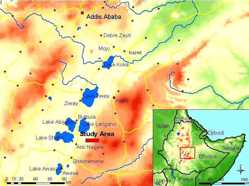
Fig. 1. Location of the study area (source: Ormsby 2001, modified by Rückamp)
Climate
Although there is some rain throughout the year, its general pattern is bimodal, with unreliable minor rainy season from March to May and a major rainy season from July to September. According to the meteorological records at Degaga (altitude 2000 asl), the mean annual precipitation is 1,075 mm and the mean annual temperature is 15°C (Fig. 3). At Kuke where the research station and the permanent plots are located the mean annual rainfall and temperature for the year 2002 were 1343 mm and 15°C, respectively (Fig. 2).
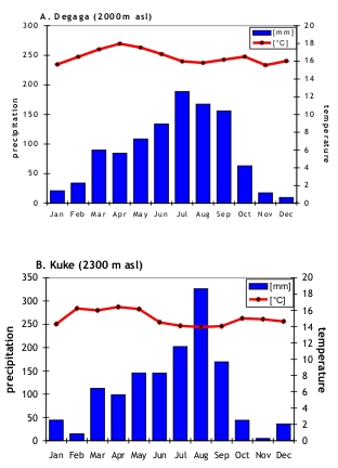
Fig. 2. Mean annual rainfall and mean annual temperature of the study area, A=Degaga, mean values averaged over 18 years for rainfall and 16 years for temperature. B=Kuke, mean rainfall and temperature for the year 2002 as taken by ųMETOS weather station
Soils and Vegetation
Soils are rich in clay and show altitudinal zonation owing to the homogenous volcanic parent material. Thus, the soils from the lower to the higher altitude are Vertisols, Planosols, Mollic Nitisols, Humic Umbrisols, Mollic Cambisols, and Niti-umbric Alisols.
The forest is highly disturbed by selective logging and cattle grazing. Vegetation of the natural forest is dominated by the canopy species Podocarpus falcatus (Thunb.) Mirb, Croton macrostachys Hochst. Ex Del., Olea europea ssp cuspidate (Wall. Ex. De) Cifferri., Schefflera abyssinica Harms and Allophyllus abyssinica (Hochst) Radlkofer (Abate 2004). In the low land savanna Acacia species are dominant, in the mountain savanna Hagenia abyssinica J. F. Gmel. and Schefflera volkensii Harms are dominant. The human influence is greater in the savannas. Most parts of the forest are logged and converted into cultivated fields or grazing land. The main crops cultivated in the lowland savanna are teff, wheat, maize and sorghum and in mountain savanna barley is most dominant. Figure 3 shows the soil and vegetation of the study area.
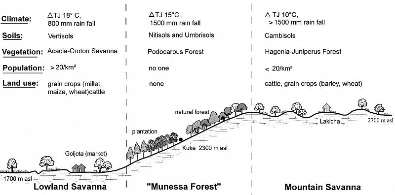
Fig. 3. Soils and vegetation of the study area
The Research Station
In order to facilitate the work of the researchers, a research station has been built close to the permanent plots. The station can accommodate up to 20 researchers at a time. Figure 4 shows the research station.
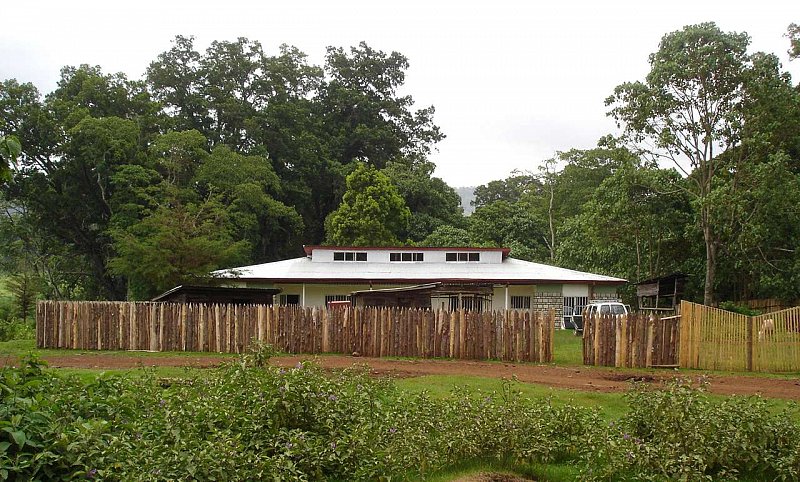
Fig. 4. The research station